Contour Maps in Surveying
-
Land Surveying

How To Measurement of Horizontal Distance Using Auto Level
How To Measurement of Horizontal Distance Using Auto Level The auto level is a surveying and construction tool utilized to…
Read More » -
Land Surveying

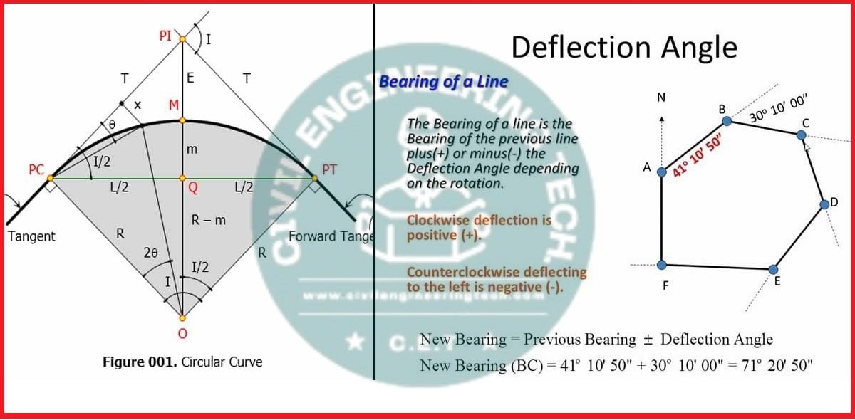
What is Deflection Angle in Surveying
Deflection angle in Surveying Definition A deflection angle is an angle which is the survey line makes with the prolongation…
Read More » -
Land Surveying
What is contour interval and Uses of contour maps in surveying
What is Contour Interval and Uses of Contour Maps in Surveying Let’s explore a few frequently asked questions regarding the…
Read More » -
Civil Engineering

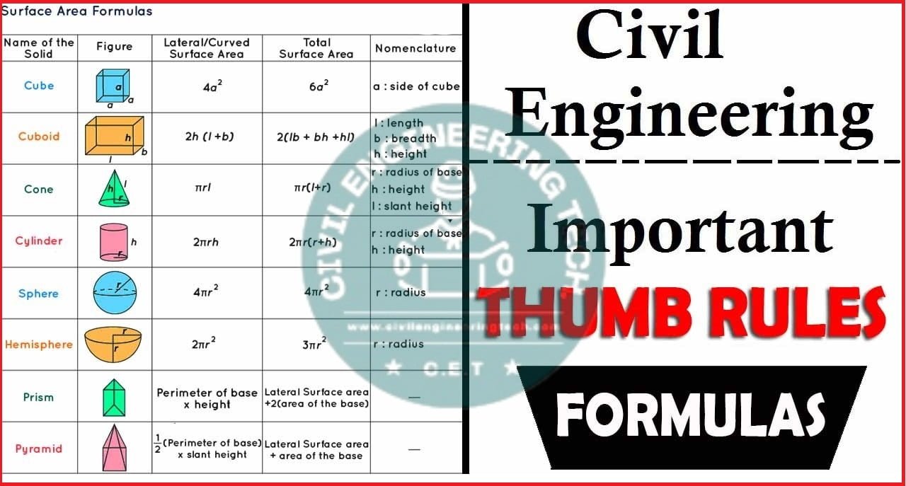
Thumb rule for Civil Engineers
Thumb rule for Civil Engineers It is imperative for any Civil Engineer, site engineer, or civil Supervisor to have a…
Read More » -
Civil Engineering

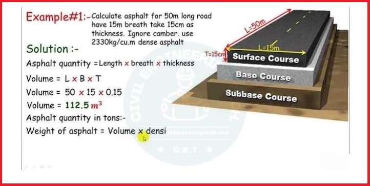
How To Calculate the Asphalt Quantity For Road
How To Calculate the Asphalt Quantity For Road Numerous individuals often mistake asphalt for bitumen. Despite common belief, asphalt and…
Read More »